
|
|
|
ProximityOne Main VDAGIS Related Sections - States - Metros - Congressional District - Counties - Cities/Places - Tracts/Neighborhoods - Block Groups - Census Blocks - ZIP Codes - Urban Areas |
September 9, 2025. The Visual Data Analysis (VDA) Geographic Information System (GIS) is a computer-based tool that allows users to store, analyze, visualize, and interpret geographic data. VDA GIS tools are structured for online (VDAW4/iVDA) and offline (VDAD) use and operation with Windows, Mac and iPhone devices. This section provides basic information regarding VDAW4 and iVDA. These tools may be used with user projects or VDA Projects. See available projects at this main project list. This document is provides a summary of basic VDAW4/iVDA usage. Topics Getting Started Layout/Organization Layers Main Menu File Database Zoom Tools Help Table/Query Subscription About Getting Started -- Using iVDA .. goto top .. This frame shows iVDA used with demographic layers. .. The starting view shows the lower 48 states by county. .. The page being viewed is located at https://proximityone.com/vdaw_guide.htm Visual Data Analytics - American Community Survey/Population Trends Project .. about Layout/Organization .. goto top Description of User Interface Main Menu Search bar Map Window Version Up Down Legend Panel Data Panel Copy grid button Copy Latlon button Buttons below Map Window ZOOM/Shift+drag Arrow -- drag entire map + - -- incremental zooms Globe -- recenter lower 48 Clear Table/Query -- start Table/Query -- splits map window Layers .. goto top This specific GIS project (above, see legend panel) has these layers. Clicking the name of a layer makes that layer the active layer. States -- States population & components of change 2020-24 CBSA/MSA -- Metros population & components of change 2020-24 Cities %PopChg 20-24 -- cities population 2020-2024; Population Change 2020-24 County Annual Population -- Counties population & components of change 2020-24 County Cen2020 DP1 -- Counties Census 2020 Demographic Profile 1 County ACS235 Itemset1 -- Counties by American Community Survey 2023 5 year itemset1 CBSA/MSA ACS235 Itemset1 -- Core-Based Statistical Areas by American Community Survey 2023 5 year itemset1 CD119 ACS231 Itemset1 -- 119th Congressional Communities by American Community Survey 2023 1 year itemset1 CC119 ACS235 Itemset1 -- 119th Congressional Communities by American Community Survey 2023 5 year itemset1 Tracts ACS235 Itemset1 -- Census Tracts by American Community Survey 2023 5 year itemset1 BaseLayer1 -- raster graphics topo map States1 File .. goto top • Userfile download • Userfile upload • Save Project • Open Project An Example/Application Consider the application of copying .. the median age by county layer (County 2024 Median Age) layer .. from the VDA GIS project "Population County -- Age/Gender" .. to the VDA GIS project "American Community Survey 2023 County Data Profiles". Complete the following steps using VDAW4. You will be able to display median age by county (a label) and median age by county (a label) from the ACS 2023 county file (item D018). Userfile download First, select the project where the layer is located. e.g., Population County -- Age/Gender With a project open, select a layer making it the active lauer (left click name) Click the Userfile download. A form appears. Click the Make Shapefile. The name of the shapefile is shown; it will not be familiar and is assigned by the system. Click the Download button; the downloaded file will be in a folder on your computer. The shapefile correponding to that layer has been downloaded. Close the Userfile download frame. Userfile upload First, select the project where the layer is to be added e.g. American Community Survey 2023 County Data Profiles. Click the Userfile upload. A form appears. Click the Choose file. The name of the shapefile is shown; assigned by the system. Select the shapefile to be added. This name is a ZIP file and was stored on your computer. A new layer is added at the top of the Legend Panel corresponding to the shapefile. Close the Userfile upload form. The map window shows the shapefile as the top layer. It has a gray fill pattern. Optionally modify the layer attributes with the Tools>Layer Editor. Add a label (medage as upper, center) Optionally move the new layer down with the up/down feature. Save Project Click the Save button to save the project e.g. while American Community Survey 2023 County Data Profiles with new layer is opened. The original project will not be affected. Open Project Any authorized user can now open the new project. The new project name is not promoted or listed. To Open the project with the added layer, click Opem Project. a form opens showing the projects saved using this method. the most recent project saved is shown at top. Displaying and interpreting the differences in ages. Why is there a difference in the two median ages diaplayed? 1) the ACS 2023 data are 5-year estimates based on a survey (the latest) -- centric to 2021 2) the data from the 2024 median age by county are two years more recent and based on model-based estimates. ACS 2023 data are 5-year estimates based on a survey (the latest) -- centric to 2021 .. zoom in to Kansas counties .. click graphic for larger view  .. Sedgwick County (Wichita) .. median age 35.9 years (statistical survey with MOE known) 2024 median age by county are two years more recent and based on model-based estimates .. click graphic for larger view 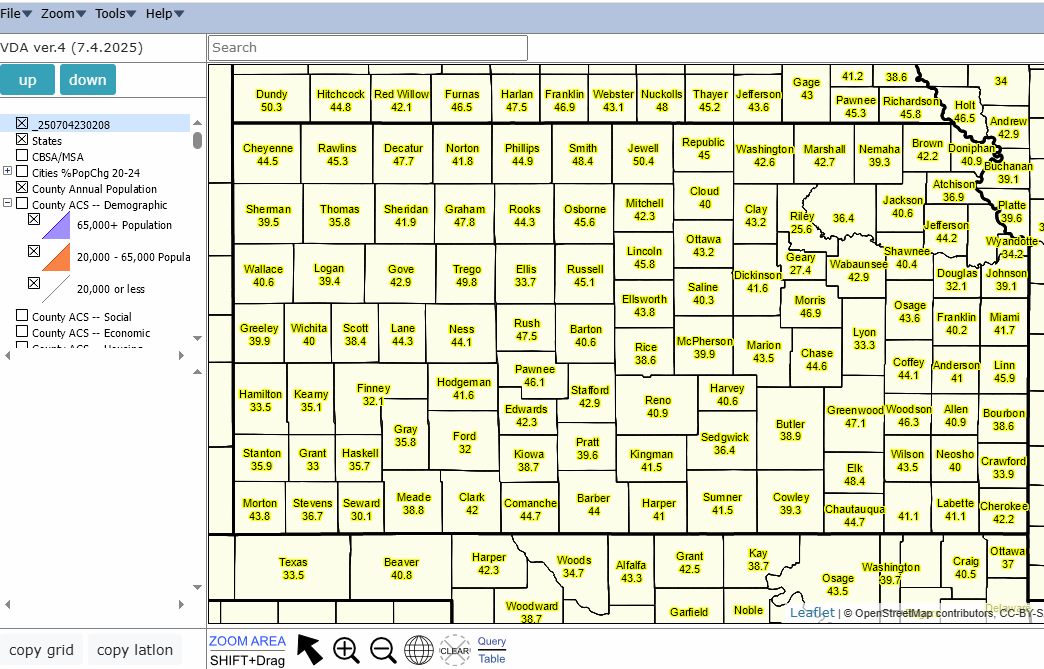 .. zoom in to Kansas counties .. Sedgwick County (Wichita) .. median age 36.4 years (model-based, no MOE available) Database .. goto top Database includes Windows applications listed below. Without setting up your computer to use these applications, they will not operate. Each Windows application requires a registry entry. At this time, these applications work on/use only local data files. More on this later. Make a unique directory, for example c:\VDAGIS1, that will be used to house the applications and related data. 1. County Projections Explorer (CPE) Expand the CPE file to c:\VDAGIS1 2. dBTools Expand the DBTools file to c:\VDAGIS1. 3. ChartGraphics Expand the ChartGraphics file to c:\VDAGIS1. 4. Expand this zip file (registry bats) to c:\VDAGIS1. To launch a Windows .exe file from a web browser, you must register it in the registry of your computer. The above zip contains batch files to automate this process. addreg.bat delreg.bat 5. From that same folder, run (from command prompt in c:\vdagis1) addreg [application name]. Examples: If the application is cpe.exe, run addreg cpe .. if dBTools.exe, run addreg dBTools .. if Chartgraphics.exe, run addreg ChartGraphics Click OK or YES to the message dialog. If you want to remove the registry entry created, run the following command from an elevated (Administrator) Command Prompt: delreg [application name] Example: delreg cpe You should now be able to see/use the Windows applications from iVDA. Remember that the files used are local to your computer. Zoom .. goto top Tools .. goto top • Layer Editor • GeoSelect • Site Analysis • Create Heatmap • IP location Help .. goto top Table/Query .. goto top The Table/Query button (below Map Window at right) splits the Map Window showing attributes of records from the Active Layer. Fields/Controls in Table/Query • Set Field • SQL field • UID Desc • Max Count • Query button • Show Values • Map 1 Selected • Map All Selected Minimal Example of Table/Query Suppose you want to examine a set of Kansas records from the County Annual Population layer. Proceed as follows. Use the above iVDA tool and project. Make the County Annual Population the Active Layer Click the Table/Query button In the SQL Field, enter "st='20'" (omit quotes) .. the variable "st" contains the text-based state FIPS Code Click Query button. Table refreshes with 105 Kansas records. Part 2. Click the top (any) record in the Table. Next click the "Map 1 Selected" button. The Map Window zooms to that area. Subscription .. goto top Contact us .. add message in text box Terms of Use .. goto top There is no warranty regarding any aspect of this using this project. The user is solely responsible for any use made of tools and data contained in project files. About .. goto top VDAGIS tools and data have been developed and are updated/supported by Warren Glimpse/ProximityOne/Alexandria, VA USA and Takashi Hamilton/Tsukasa/Osaka, Japan. Support Using these Resources .. goto top Learn more about accessing and using demographic-economic data and related analytical tools. Join us in a Data Analytics Lab session. There is no fee for these one-hour Web sessions. Each informal session is focused on a specific topic. The open structure also provides for Q&A and discussion of application issues of interest to participants. Additional Information ProximityOne develops geodemographic-economic data and analytical tools and helps organizations knit together and use diverse data in a decision-making and analytical framework. We develop custom demographic/economic estimates and projections, develop geographic and geocoded address files, and assist with impact and geospatial analyses. Wide-ranging organizations use our tools (software, data, methodologies) to analyze their own data integrated with other data. Contact us (888-364-7656) with questions about data covered in this section or to discuss custom estimates, projections or analyses for your areas of interest. |
|
|