
|
|
|
Statistical Regions & Divisions
The United States is split up into many different regions .. some groups of states, some centered on metros and yet others. Regions are an important geography for many reasons. They are often used as data tabulation areas for statistical programs for which state and sub-state data cannot be tabulated. Due to this broader and more current data available, they are often useful as sales and marketing territories. We organize census block geography by Census Region to facilitate improved access speed and analysis of small area data crossing state boundaries. This section provides an overview of selected regions and provides interactive mapping and data access fro regions. Census Regions and Divisions Census Regions and Divisions are groups of states used by Federal statistical agencies and others to view and analyze data for geographies that are sub-national and multi-state. Regional and divisional geography can be useful for analyzing demographic and economic characteristics of groups of states to examine more macro-geo patterns and trends. Summary statistics data that may be summarized at the state level may also be summarized for regions and divisions. In addition, often subject matter cannot be estimated or tabulated at the state level but can be summarized at the Census region or divisional level. Divisions nest within regions. See the list below showing states by region within division. Regions The following graphic shows boundaries of Census regions. Click graphic for larger view. Expand browser to full window for best quality view. Use the GIS tools described below to develop thematic pattern maps for a range of data and criteria. 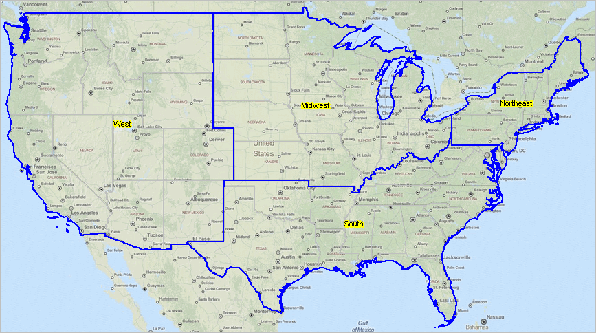 Divisions The following graphic shows boundaries of Census Divisions. Click graphic for larger view. Expand browser to full window for best quality view. Use the GIS tools described below to develop thematic pattern maps for a range of data and criteria. A limiting feature of using Census Regions/Divisions for analysis is that many split metros. 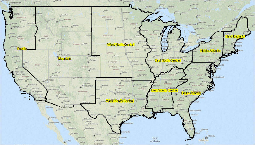 BEA Economic Areas Features of the Bureau of Economic Analysis (BEA) economic areas include: • areas are comprised of one or more counties. • areas may cross state boundaries. • areas have a Metropolitan Statistical Area (MSA) at their core. • unlike Core-Based Statistical Areas, all counties are assigned to a BEA Area. The following graphic shows boundaries of Bureau of Economic Analysis (BEA) economic areas. Click graphic for larger view. Expand browser to full window for best quality view. Use the GIS tools described below to develop thematic pattern maps for a range of data and criteria. 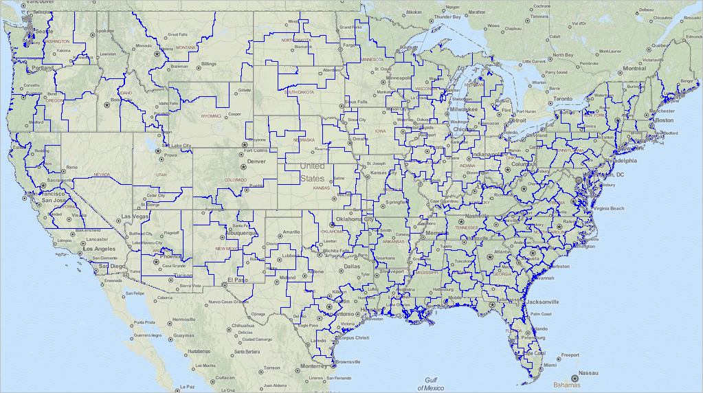 Mapping Regions & Divisions GIS Resources (requires Windows computer with Internet connection) 1. Install the ProximityOne CV XE GIS ... run the CV XE GIS installer ... take all defaults during installation 2. Download the Regions GIS project fileset ... requires ProximityOne User Group ID (join now) ... unzip Regions GIS project files to local folder c:\regions 3. Open the c:\regions\regions1.gis project ... after completing the above steps, click File>Open>Dialog ... open the file named c:\regions\regions1.gis 4. Done. The start-up view is shown at top of this section. Census Regions and Divisions with State FIPS Codes REGION I: NORTHEAST ... view BLS data for this region Division I: New England
Division 2: Middle Atlantic
REGION 2: MIDWEST ... view BLS data for this region Division 3: East North Central
Division 4: West North Central
REGION 3: SOUTH ... view BLS data for this region Division 5: South Atlantic
Division 6: East South Central
Division 7: West South Central
REGION 4: WEST ... view BLS data for this region Division 8: Mountain
Division 9: Pacific
Support Using these Resources Learn more about demographic economic data and related analytical tools. Join us in a Data Analytics Lab session. There is no fee for these Web sessions. Each informal session is focused on a specific topic. The open structure also provides for Q&A and discussion of application issues of interest to participants. ProximityOne User Group Join the ProximityOne User Group to keep up-to-date with new developments relating to geographic-demographic-economic decision-making information resources. Receive updates and access to tools and resources available only to members. Use this form to join the User Group. Additional Information ProximityOne develops geographic-demographic-economic data and analytical tools and helps organizations knit together and use diverse data in a decision-making and analytical framework. We develop custom demographic/economic estimates and projections, develop geographic and geocoded address files, and assist with impact and geospatial analyses. Wide-ranging organizations use our software, data and methodologies to analyze their own data integrated with other data. Follow ProximityOne on Twitter at www.twitter.com/proximityone. Contact ProximityOne (888-364-7656) with questions about data covered in this section or to discuss custom estimates, projections or analyses for your areas of interest. |
|
|