
|
|
|
|
Topographic Maps This section describes three types of topographic maps that can be used with VDA GIS Web or iVDA versions dated 12/6/25 or more recent and any VDA GIS project. The iVDA, shown below, is an embedded variation of the fullscreen VDA GIS Web. The topographic maps are standard, satellite and relief. Each is a global topographic map and is independent of the project used. They may be viewed using the icon that opens as a dropdown located in the upper right corner of the map panel. This is illustrated in the iVDA map shown below. Using iVDA .. The starting view shows the lower 48 states. .. the page being viewed is located at https://proximityone.com/vdagis_topomaps.htm Uncheck the layer named "County Pop Gain/Loss 2020-24" to show state transaparent boundaries to generate these views: Standard Topographic .. goto top 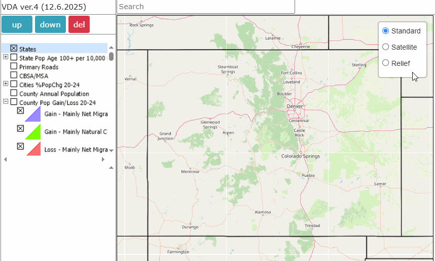 Satellite Topographic .. goto top 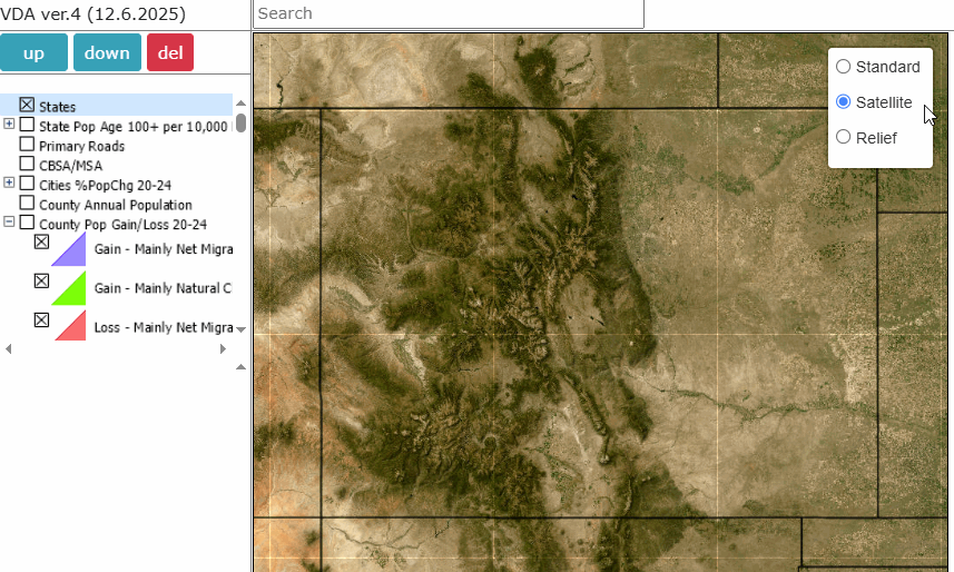 Relief Topographic .. goto top 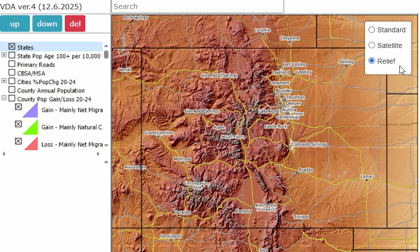 Pattern Analysis with Relief Topographic .. goto top The following view shows a semitransparent pattern view of the "County Pop Gain/Loss 20-24" layer with the Relief Topology and demographic profile (lower left panel) of a selected county. 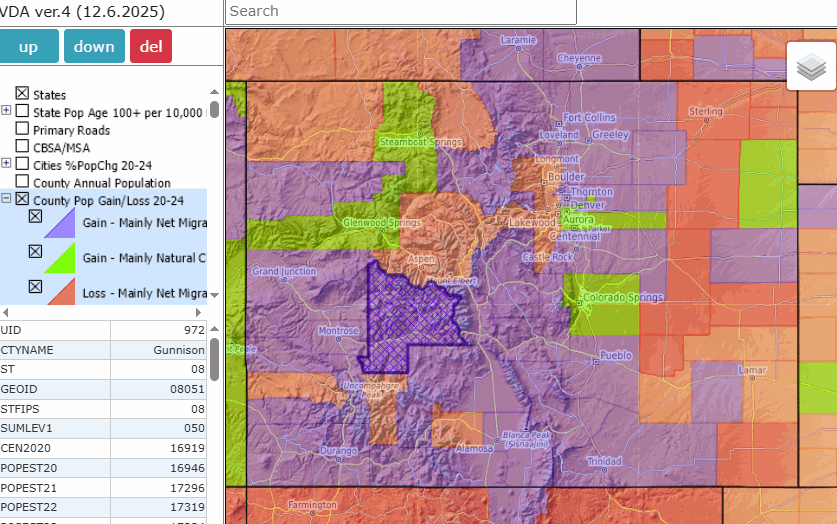 VDA GIS resources have been developed and are maintained by Warren Glimpse, ProximityOne (Alexandria, VA) and Takashi Hamilton, Tsukasa Consulting (Osaka, Japan). Support Using these Resources Learn more about accessing and using demographic-economic data and related analytical tools. Join us in a Data Analytics Lab session. There is no fee for these one-hour Web sessions. Each informal session is focused on a specific topic. The open structure also provides for Q&A and discussion of application issues of interest to participants. ProximityOne User Group Join the ProximityOne User Group to keep up-to-date with new developments relating to geographic-demographic-economic decision-making information resources. Receive updates and access to tools and resources available only to members. Use this form to join the User Group. Additional Information ProximityOne develops geographic-demographic-economic data and analytical tools and helps organizations knit together and use diverse data in a decision-making and analytical framework. We develop custom demographic/economic estimates and projections, develop geographic and geocoded address files, and assist with impact and geospatial analyses. Wide-ranging organizations use our tools (software, data, methodologies) to analyze their own data integrated with other data. Contact ProximityOne (888-364-7656) with questions about data covered in this section or to discuss custom estimates, projections or analyses for your areas of interest. |
|
|