
|
|
|
.. ZIP Code 2023 ACS Data Profiles: Demographic, Social, Economic, Housing .. use with Visual Data Analytics (VDA) Geographic Information Systems (GIS) The primary purpose of using the ZIP Code ZCTA project is to provide mapping and related support for the demographic-economic estimates. For example, development of a view of 2023 America Community Survey percent high school graduates or median household income. Use the data contained in the Demographic, Social, Economic, Housing layers described in detail by the metadata files. Understanding ZIP Codes vs ZCTAs It is important to distinguish between ZIP Codes and ZIP Code Tabulation Areas (ZCTAs): ZIP Codes (USPS) • Used by USPS for mail delivery as lines, not polygons. • Often dual-sided (each side of a street may belong to a different area). • No official ZIP Code area polygons or shapefiles are produced by the USPS or other agencies. ZCTAs (Census Bureau) • Polygonal areas developed by the U.S. Census Bureau for data tabulation. • Emulate ZIP Codes, based on respondent data. • Not all areas have mail delivery; ZCTAs do not cover the entire U.S. • Data for ZCTAs are tabulated from the Census, ACS, and other programs. • Developed once per decade. • Approximately 33,171 ZCTAs, compared to about 44,000 ZIP Codes. • ZCTAs do not include P.O. Boxes or FPO military codes; accounting for difference. Using the ZIP Code ZCTA VDA GIS Project To find a ZIP Code/ZCTA: 1. Enter the 5-digit ZIP Code in the iVDA interactive mapping search bar and press Enter. 2. The map view will relocate to the corresponding ZIP Code/ZCTA. 3. Enter your own ZIP Code to explore the data. Role of GIS and Analysis of ZIP Codes/ZCTA Areas Use the ZIP Code ZCTA American Community Survey Data Profiles (ZIP_DP) GIS project using iVDA (this page) or VDAW4. The start-up view of the ZIP DP GIS project using iVDA is shown below. Using iVDA with ZIP Code ZCTA ACS DP Project .. goto top .. lower 48 states shown in Map Window. .. the page being viewed is located at https://proximityone.com/zip_dp.htm Metadata Metadata files describe the fields in corresponding layers, with illuatrative sample views (click graphic for larger view). .. each graphic shows view of item from that layer. ACS Demographic XLS -- 94 statistical items percent Hispanic by ZCTA 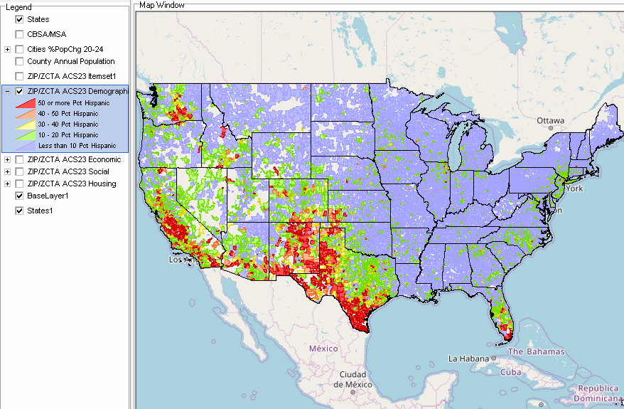 ACS Social XLS -- 154 statistical items percent College Graduates by ZCTA 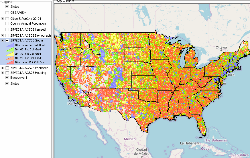 ACS Economic XLS -- 137 statistical items Median Household Income 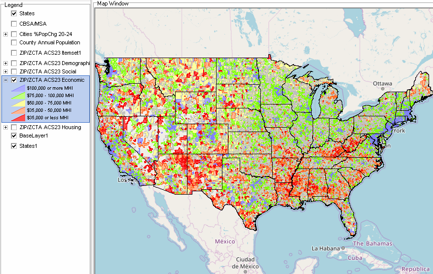 ACS Housing XLS -- 143 statistical items Median Housing Value 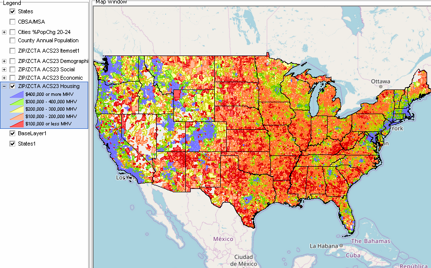 About iVDA & VDAGIS .. goto top iVDA is an HTML iframe embedded version of VDA Web GIS. VDAGIS tools and data have been developed and are updated/supported by Warren Glimpse/ProximityOne/Alexandria, VA USA and Takashi Hamilton/Tsukasa/Osaka, Japan. Support Using these Resources .. goto top Learn more about census tract demographic economic data and related analytical tools. Join us in a Data Analytics Lab session. There is no fee for these informal sessions focused on your interests. The open structure provides for Q&A and discussion of application issues of interest to participants. Terms of Use .. goto top There is no warranty regarding any aspect of this using this project. The user is solely responsible for any use made of iVDA or data contained in project files. Contact ProximityOne (888-364-7656) with questions about data covered in this section or to discuss custom estimates, projections or analyses for your areas of interest. |
|
|