
|
|
|
.. 2023 County Data Profiles: Demographic, Social, Economic, Housing .. use with Visual Data Analytics (VDA) Geographic Information Systems (GIS) A Geographic Information System (GIS) is a computer -based tool that allows users to store, analyze, visualize, and interpret geographic data. Geographic data, also known as spatial or geospatial data, identifies the location of features on earth. GIS combines the visual elements of maps with the ability to link characteristics about those features in datasets. This relationship allows GIS to locate, display, analyze, and model data. GIS technology integrates geographic data with statistical and adminstrative data using statistical methods and analytics. These abilities make GIS valuable to a wide range of public and private enterprises for explaining events, predicting outcomes and planning strategies. And collaborating on those issues. Start the American Community Survey Data Profiles (ACSDP) GIS project using iVDA or VDA4. The start-up view of the ACSDP GIS project using iVDA is shown below. Using iVDA with ACSDP Project .. goto top .. the page being viewed is located at https://proximityone.com/acsdp.htm Static view of the U.S. lower 48 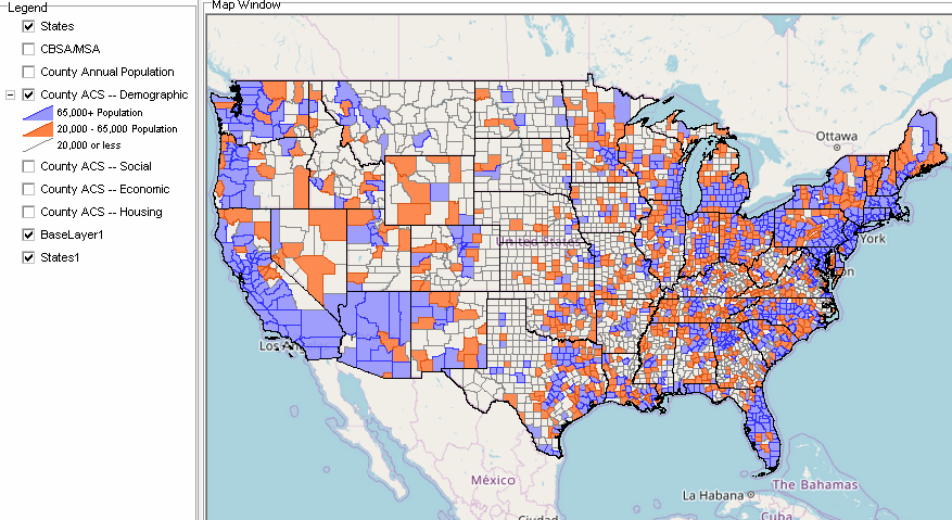 The primary purpose of this project is to provide mapping and related support for the demographic-economic current estimates data projections (outlook.exe). Metadata describing fields in corresponding layers are shown below. County ACS -- Demographic XLS -- 94 statistical items County ACS -- Social XLS -- 154 statistical items County ACS -- Economic XLS -- 137 statistical items County ACS -- Housing XLS -- 143 statistical items Application Example Create this map showing CVAP by county. Use the tools to make variations of this view. Uses ACS 2023 5 year data. 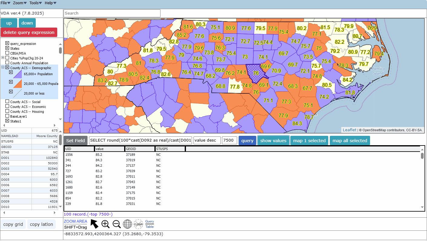 Start mapping: https://proximityone.com/vdaw4_menu.html Select Group One project County American Community Survey 2023 Data Profiles Set view to NC Unselect layer County Annual Population Select layer County ACS-Demographic Click Query/Table button below map at right Copy/paste this query into the SQL edit box SELECT round(100*cast(D092 as real)/cast(D001 as real),1) as value, geoid, stusps where stusps='NC' and value > 0 .. D092 CVAP .. D001 total population Key in value desc Click Query button Click Show values button Done. End this section Terms of Use .. goto top There is no warranty regarding any aspect of this using this project. The user is solely responsible for any use made of iVDA or data contained in project files. About iVDA & VDAGIS .. goto top iVDA is an HTML iframe embedded version of VDA Web GIS. VDAGIS tools and data have been developed and are updated/supported by Warren Glimpse/ProximityOne/Alexandria, VA USA and Takashi Hamilton/Tsukasa/Osaka, Japan. Support Using these Resources .. goto top Learn more about census tract demographic economic data and related analytical tools. Join us in a Data Analytics Lab session. There is no fee for these informal sessions focused on your interests. The open structure provides for Q&A and discussion of application issues of interest to participants. Additional Information .. goto top ProximityOne develops geographic-demographic-economic data and analytical tools and helps organizations knit together and use diverse data in a decision-making and analytical framework. We develop custom demographic/economic estimates and projections, develop geographic and geocoded address files, and assist with impact and geospatial analyses. Wide-ranging organizations use our tools (software, data, methodologies) to analyze their own data integrated with other data. Contact ProximityOne (888-364-7656) with questions about data covered in this section or to discuss custom estimates, projections or analyses for your areas of interest. |
|
|