
|
|
|
-- demographic-economic-geographic data & analysis January 2023 .. the exact geographic definition of a neighborhood is elusive; neighborhood geography is not defined by a national standard. Many areas have multiple neighborhood renderings. While many counties/cities have well defined neighborhoods, most do not. To examine the demographic-economic characteristics of a neighborhood, the best options are to use a combination of census blocks, block groups and census tracts. This section provides an overview of tools and data to examine 2020 U.S. national scope census tracts as a neighborhoods psuedo geography using Geographic Information System (GIS) tools. A core Neighborhoods GIS project and related datasets has been developed using all data profiles (details below) from the American Community Survey (ACS2021) 2021 5-year estimates. Neighborhoods GIS Project The following graphic shows the Neighborhood GIS project start-up view when started using VDA Desktop or VDA Web GIS. The legend panel at the left shows census tract/neighborhood layers. Each corresponds to a selected item from the four data profiles. The legend shows how the colors in the map window correspond to the selected item data values. This following map shows patterns of median household income for the DP3 layer. See examples for each of the four DP profiles below. In this view, it is easy to see how patterns of economic prosperity vary across the U.S. and how they cluster, or do not, across states based on this one measure. In addition, zooming in reveals patterns not possible to see at the national level. 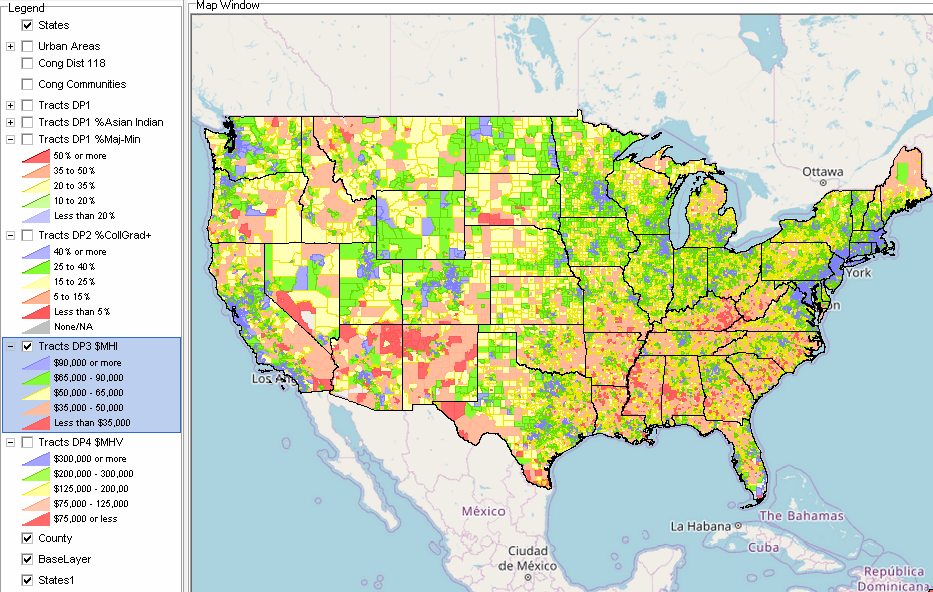 .. click graphic for larger view; expand broswer window for best possible view. Examine a Neighborhood The following view shows a drill down to the Scottsdale, AZ area. The 11 character census tract code is shown with the yellow label within the tract. The median household income is shown with a solid white label. The DEDE generated comparative analysis profile compares tract 04013108400 with tract 04013108502. This profile shows all DP1 through DP4 fields. 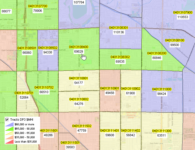 Create a similar view for your own area of interest. Neigbborhood Analysis Using VDA GIS Tools Use the Visual Data Analytics (VDA) Web GIS to map and geospatially analyze schools and school districts in context of other geography and subject matter. GIS (Geographic Information System) tools can do more than just make maps. They help us understand patterns and relationships that can only be with this technology. Below are some examples of using VDA GIS tools. VDA GIS and related data have been developed by Warren Glimpse/ProximityOne/Alexandria, VA USA and Takashi Hamilton/Tsukasa/Osaka, Japan. All that is required to use VDA Web GIS is a Web browser. iOS and Android versions are supported. Neighborhood Patterns of %Majority-Minority Population  Neighborhood Patterns of Educational Attainment 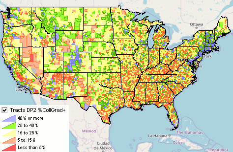 Neighborhood Patterns of Median Household Inocme 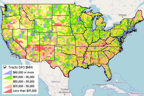 Neighborhood Patterns of Median Housing Value 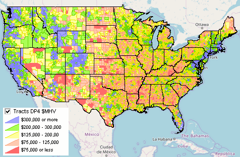 Neighborhoods GIS Project Structure
Scope of Tract Subject Matter The DEDE generated comparative analysis profile compares tract 04013108400 with tract 04013108502. This profile shows all DP1 through DP4 fields. The GIS project includes four tract shapefiles with different integrated subject matter. - Tracts DP1 -- 89 general demographics "D" items -- ACS2021 data for each tract - Tracts DP2 -- 143 social characteristics "S" items -- ACS2021 data for each tract - Tracts DP3 -- 137 economic characteristics "E" items -- ACS2021 data for each tract - Tracts DP4 -- 143 housing characteristics "H" items -- ACS2021 data for each tract Contact ProximityOne (888-364-7656) with questions about data covered in this section or to discuss custom estimates, projections or analyses for your areas of interest. |
|
|