
|
|
|
April 2020 .. as COVID-19 impacts our demographics, economy and way of life, we look for answers about where we are and what lies ahead. This section provides a partial view -- data on COVID-19 incidence and tools to analyze those data. In the coming days, weeks, we plan to augment these tools and data. See more below. Use resources made available through this section to examine/analyze patterns of COVID-19 incidence in context of related demographic-economic characteristics. Resources include the narrative/interpretative portion, interactive table and GIS tools and project/files. Data and tools are updated daily. There is no fee to use any of these resources. See terms of use. We want to hear from you. Please send us an email to let us know of questions and how to improve these resources. COVID-19 Incidence by County in the Atlanta Metro Area The following graphic shows patterns of COVID-19 incidence (number of cases per 1,000 population) by county in context cases per 1,000 population (county thematic pattern). See color patterns/intervals in the inset legend. This view shows counties labeled with name and number of confirmed COVID-19 cases. Use the GIS project described below to create variations of this view and develop similar views for any metro.  .. view developed with ProximityOne CV XE GIS and related GIS project. .. updated with 4/17/20 data. Make your own regional views using GIS tools. See below. COVID-19 Incidence by County in Context of Population Density The following graphic shows patterns of COVID-19 incidence (number of cases per 1,000 population) by county similar to the graphic above. See color patterns/intervals in the inset legend. This view shows counties labeled with name and number of confirmed COVID-19 cases by county in context of population density, population per square mile, (county thematic pattern). Use the GIS project described below to create variations of this view and develop similar views for any metro. Click graphic for larger view showing the U.S. by county population density thematic pattern map. Expand browser to full screen for best quality view. Atlanta metro area shown with bold brown boundary.  .. view developed with ProximityOne CV XE GIS and related GIS project. .. updated with 4/17/20 data. The GIS resources and interactive table below makes use of the COVID-19 confirmed cases data updated daily by the New York Times. See more about the New York Times U.S. tracking page. COVID-19 Incidence -- U.S. by County Similar to the above view, the following graphic shows patterns of COVID-19 incidence (number of cases per 1,000 population) by county for the U.S. See color patterns in the inset legend. This view shows counties labeled with name and number of confirmed COVID-19 cases. Use the GIS project described below to create variations of this view and develop similar views for any metro. Click graphic for larger, more detailed view. Expand browser window for best quality view.  .. view developed with ProximityOne CV XE GIS and related GIS project. .. updated with 4/17/20 data. COVID-19 Confirmed Cases by County Interactive Table .. goto top Updated with 4/17/20 data. Click ShowAll button between Find/Queries. Use mouseover on column header to view column description. See usage notes below table. See related interactive tables. Usage Notes • If table not showing any rows; click ShowAll button below table. • Use vertical and horizontal scroll bars to navigate up/down or left/right. • Adjust column widths using column divider between header cells. • County button -- click county button to refresh table with counties only. .. a useful feature to rank/compare all counties or a set of counties without state & national rows. • Find Name> button -- use to select area name on exact spelling of partial name in column 1. .. Key in exact up/low case spelling of partial name of srea in the edit box to right of Find Name> button. .. overwriting the value Cobb .. click the Find Name> button ... table refreshes with all areas with matched spelling in column 1. • Find StCty> button -- use to select area on exact spelling of code in column 5. .. Key in exact spelling of the StCty code for srea in the edit box to right of Find StCty> button. .. overwriting the value 13067 .. click the Find StCty> button ... table refreshes with all areas with matched spelling in column 5. Installing & Using the GIS Project .. goto top The COVID-19 data have been added as two U.S. by county Layers to the default GIS project included with the CV XE GIS installer and installer update. See layers in graphic shown below (Cases Label and Cases/1000 Pop). 1. Install the ProximityOne CV XE GIS on any Windows computer ... run the CV XE GIS installer ... requires your userid .. no cost .. signup here ... take all defaults during installation 2. The GIS project automatically opens with the following view: 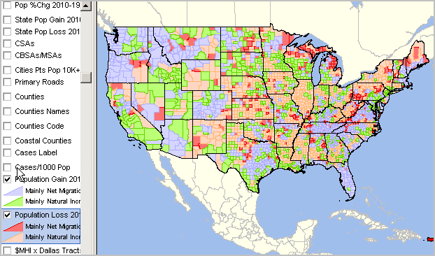 ... click the checkbox by the "Cases/1000 Pop" layer showing in legend at left of map window. ... the view now appears similar to the U.S. by county map shown above. ... see the CV XE GIS User Guide for more information about CV XE GIS operations. ... join us in a Data Analytics Web Session for demonstration and to discuss applications. Updates The file containing the COVID-19 data, part of the installer, is updated daily. The installer is also updated daily. Run the CV XE GIS update installer to access the latest data. Running this installer will update your data. GIS Projects There are three GIS projects included with the installer. Each GIS project uses the same set of files. The projects differ only in start-up view. 1. US1.GIS project -- the default GIS project -- as shown in view above. with CV XE GIS running use File>Open>Dialog and open the file c:\cvxe\us1.gis 2. US1_ATL.GIS project -- opens with the Atlanta area view as shown at top of this section. with CV XE GIS running use File>Open>Dialog and open the file c:\cvxe\us1_atl.gis 3. US1_ATL_DENSITY.GIS project -- opens with the Atlanta area denisty view as shown above. with CV XE GIS running use File>Open>Dialog and open the file c:\cvxe\us1_atl_density.gis Terms of Use .. goto top The CV XE GIS project with integrated COVID-19 data is available for use by members of the ProximityOne User Group and licensed users of the CV XE GIS software. There is no warranty of any type associated with any aspect of the use of the CV XE GIS software, related GIS project and files, nor information provided via this or related ProximityOne resources. The user is solely responsible for any use made of any of these resources. Software and data resources may not be redistributed. Change -- What, Where, When, How Much .. and the Impact .. goto top Individuals, households, communities and stakeholders look ahead with questions ... what's next .. what will change when, where and how will we be impacted. ProximityOne plans to develop and share current information, monthly updates, and forecasts for the year ahead at the city/county level on a national scope. Using most current observed data and models, we develop current estimates and projections for selected demographics and economic measures. Among these measures are the local employment situation (total population, employed and unemployed) and employment, establishments and earnings by type of business/sector. These estimates and projections will be organized into datasets that can be analyzed using analytical tools of choice. As an example, the Bureau of Labor Statistics (BLS) produces monthly estimates of employment and unemployment for all counties and cities 25,000 population and over. Data for January 2020 were released on March 20, 2020. Data for February 2020 will be released April 8, 2020; data for March 2020 will be released April 29, 2020. The corresponding ProximityOne April 2020 through July 2020 estimates are planned for release in early May 2020 and will be updated/extended by one month going forward. A second example, BLS also produces quarterly estimates of the number of establishments, employment and earnings by type of business for all counties. Data for 2019Q4 will be released on June 3, 2020 (roughly 6 month lag). The corresponding ProximityOne 19Q4, 20Q1 and 20Q2 estimates (2-digit NAICS detail) are planned for release in early May 2020 and will be updated/extended by one quarter going forward. Be a part of this collaborative effort. Join in now for updates -- send us an email, share your thoughts and questions. We will share updates as we proceed. ProximityOne User Group .. goto top Join the ProximityOne User Group to keep up-to-date with new developments relating to metros and component geography decision-making information resources. Receive updates and access to tools and resources available only to members. Use this form to join the User Group. Support Using these Resources .. goto top Learn more about accessing and using demographic-economic data and related analytical tools. Join us in a Data Analytics Lab session. There is no fee for these one-hour Web sessions. Each informal session is focused on a specific topic. The open structure also provides for Q&A and discussion of application issues of interest to participants. Additional Information ProximityOne develops geodemographic-economic data and analytical tools and helps organizations knit together and use diverse data in a decision-making and analytical framework. We develop custom demographic/economic estimates and projections, develop geographic and geocoded address files, and assist with impact and geospatial analyses. Wide-ranging organizations use our tools (software, data, methodologies) to analyze their own data integrated with other data. Follow ProximityOne on Twitter at www.twitter.com/proximityone. Contact us (888-364-7656) with questions about data covered in this section or to discuss custom estimates, projections or analyses for your areas of interest. |
|
|