|
|
|
PUMA 2012 Demographic-Economic Interactive Table -- Public Use Microdata Area Housing Characteristics
The U.S. national scope Public Use Microdata Area (PUMA) 2012 Demographic-Economic Dataset contains approximately 600 subject matter items tabulated for each 2010 PUMA organized into four subject matter groups: • General Demographics • Social Characteristics • Economic Characteristics • Housing Characteristics (this section) These data are based on the American Community Survey (ACS) 2012 1-year estimates. More about these data. See similar ranking tables: Census Tracts | School Districts | Cities | ZIP Codes | State, Metro & County. Use the interactive ranking table in this section to view, query, rank, compare housing characteristics of these areas. The scroll box shown below lists each of the subject matter items available for each area via the ranking table. The number at the left of the subject matter item is also used as the short name for the subject matter item in the column header in the ranking table. Use the CV APIGateway for more detail, alternative formats and data extraction. Housing Characteristics Items -- scroll section
HOUSING OCCUPANCY
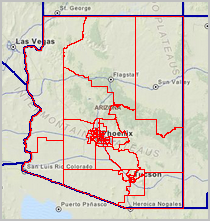
H001 Total housing units H002 Occupied housing units H003 Vacant housing units H004 Homeowner vacancy rate H005 Rental vacancy rate UNITS IN STRUCTURE H006 Total housing units H007 1-unit, detached H008 1-unit, attached H009 2 units H010 3 or 4 units H011 5 to 9 units H012 10 to 19 units H013 20 or more units H014 Mobile home H015 Boat, RV, van, etc. YEAR STRUCTURE BUILT H016 Total housing units H017 Built 2010 or later H018 Built 2000 to 2009 H019 Built 1990 to 1999 H020 Built 1980 to 1989 H021 Built 1970 to 1979 H022 Built 1960 to 1969 H023 Built 1950 to 1959 H024 Built 1940 to 1949 H025 Built 1939 or earlier ROOMS H026 Total housing units H027 1 room H028 2 rooms H029 3 rooms H030 4 rooms H031 5 rooms H032 6 rooms H033 7 rooms H034 8 rooms H035 9 rooms or more H036 Median rooms BEDROOMS H037 Total housing units H038 No bedroom H039 1 bedroom H040 2 bedrooms H041 3 bedrooms H042 4 bedrooms H043 5 or more bedrooms HOUSING TENURE H044 Occupied housing units H045 Owner-occupied H046 Renter-occupied H047 Average household size of owner-occupied unit H048 Average household size of renter-occupied unit YEAR HOUSEHOLDER MOVED INTO UNIT H049 Occupied housing units H050 Moved in 2005 or later H051 Moved in 2000 to 2004 H052 Moved in 1990 to 1999 H053 Moved in 1980 to 1989 H054 Moved in 1970 to 1979 H055 Moved in 1969 or earlier VEHICLES AVAILABLE H056 Occupied housing units H057 No vehicles available H058 1 vehicle available H059 2 vehicles available H060 3 or more vehicles available HOUSE HEATING FUEL H061 Occupied housing units H062 Utility gas H063 Bottled, tank, or LP gas H064 Electricity H065 Fuel oil, kerosene, etc. H066 Coal or coke H067 Wood H068 Solar energy H069 Other fuel H070 No fuel used SELECTED CHARACTERISTICS H071 Occupied housing units H072 Lacking complete plumbing facilities H073 Lacking complete kitchen facilities H074 No telephone service available OCCUPANTS PER ROOM H075 Occupied housing units H076 1.00 or less H077 1.01 to 1.50 H078 1.51 or more VALUE H079 Owner-occupied units H080 Less than $50,000 H081 $50,000 to $99,999 H082 $100,000 to $149,999 H083 $150,000 to $199,999 H084 $200,000 to $299,999 H085 $300,000 to $499,999 H086 $500,000 to $999,999 H087 $1,000,000 or more H088 Median (dollars) MORTGAGE STATUS H089 Owner-occupied units H090 Housing units with a mortgage H091 Housing units without a mortgage SELECTED MONTHLY OWNER COSTS (SMOC) H092 Housing units with a mortgage H093 Less than $300 H094 $300 to $499 H095 $500 to $699 H096 $700 to $999 H097 $1,000 to $1,499 H098 $1,500 to $1,999 H099 $2,000 or more H100 Median (dollars) H101 Housing units without a mortgage H102 Less than $100 H103 $100 to $199 H104 $200 to $299 H105 $300 to $399 H106 $400 or more H107 Median (dollars) SELECTED MONTHLY OWNER COSTS AS A PERCENTAGE OF HOUSEHOLD INCOME (SMOCAPI) H108 Housing units with a mortgage (excluding units where SMOCAPI cannot be computed) H109 Less than 20.0 percent H110 20.0 to 24.9 percent H111 25.0 to 29.9 percent H112 30.0 to 34.9 percent H113 35.0 percent or more H114 Not computed H115 Housing unit without a mortgage (excluding units where SMOCAPI cannot be computed) H116 Less than 10.0 percent H117 10.0 to 14.9 percent H118 15.0 to 19.9 percent H119 20.0 to 24.9 percent H120 25.0 to 29.9 percent H121 30.0 to 34.9 percent H122 35.0 percent or more H123 Not computed GROSS RENT H124 Occupied units paying rent H125 Less than $200 H126 $200 to $299 H127 $300 to $499 H128 $500 to $749 H129 $750 to $999 H130 $1,000 to $1,499 H131 $1,500 or more H132 Median (dollars) H133 No rent paid GROSS RENT AS A PERCENTAGE OF HOUSEHOLD INCOME (GRAPI) H134 Occupied units paying rent (excluding units where GRAPI cannot be computed) H135 Less than 15.0 percent H136 15.0 to 19.9 percent H137 20.0 to 24.9 percent H138 25.0 to 29.9 percent H139 30.0 to 34.9 percent H140 35.0 percent or more H141 Not computed Examples To determine the PUMAs with highest median income in Harris County TX ... click ShowAll button then key in a part of the PUMA name (Harris County) in the Select Area edit box below the ranking table, then click the Select Area button. When the PUMA(s) display, scroll right to item H088 in the table. Click H088 header cell twice to view these areas ranked in descending order on H088. The highest ranked PUMA is "Harris County (Northwest)--South of US-290 & West of TX-6 PUMA" with $137,300 MHV. PUMA Demographic-Economic Interactive Table -- 2012 Housing Characteristics Click column header to sort; click again to sort other direction. Mouseover column header cell to view description or use scrollbox above. See usage notes below table. See related Ranking Tables Main Page. See PUMA geographic area definitions. Usage Notes • All subject matter items are estimates for 2012. • Name/Code column: PUMA name • Use Select Area to select/filter PUMA. - Click ShowAll button first. - Key in any part of name and click Select Area button. - Search will filter for any name with that exact, case sensitive, spelling. - Maricopa is used as an example; note if clicking Select Area, many Maricopa named areas are located. ... the more specific Maricopa County may be preferred. • Optionally use splitter bar in header between cells to expand/shrink column width. - Click on splitter bar and drag left or right. • Click ShowAll button between specific queries. • Cells with -1 value could not be estimated (for this geography and this time frame). Where's my PUMA? Use the PUMA 2010 interactive table to determine which PUMA contains or intersects with a census tract, city/place or county. A more comprehensive method is to use the CV XE GIS tools and PUMA shapefile. See additional information. About these Data These data are the first "richer" demographic-economic characteristics for 2010 vintage PUMAs. 2013 annual updates for the 2010 vintage PUMAs will be available fall 2014. PUMAs cover the U.S. wall-to-wall (2,378 areas) providing the greatest geographic granularity for which "current year" demographics are available. Custom estimates may be developed using the Public Use Microdata Samples (PUMS) supplementing data provided here. PUMAs have a minimum population of 100,000 and are typically defined to be approximately that size. As a result, data correspond to geographic areas of similar population size. 2010 vintage PUMAs conform to state boundaries and where possible/applicable counties and Census 2010 census tract boundaries. Typical PUMA configurations: • One or more contiguous partial or whole counties (Madera County CA is one PUMA). • A group of contiguous census tracts within one county (Los Angeles County CA contains 69 PUMAs). Additional Information ProximityOne develops geodemographic-economic data and analytical tools and helps organizations knit together and use diverse data in a decision-making and analytical framework. We develop custom demographic/economic estimates and projections, develop geographic and geocoded address files, and assist with impact and geospatial analyses. Wide-ranging organizations use our tools (software, data, methodologies) to analyze their own data integrated with other data. Follow ProximityOne on Twitter at www.twitter.com/proximityone. Contact us (888-364-7656) with questions about data covered in this section or to discuss custom estimates, projections or analyses for your areas of interest. |
|
|