|
|
|
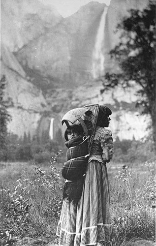
-- Demographic Economic Characteristics -- expanding insights through data analytics January 2022 .. this section explores population and demographic characteristics for each of the approximate 700 Native American areas. These important data are essential to meet needs of Native American area stakeholders, policy-makers and planning. Based on Census 2020, the total population in the combined American Indian, Alaska Native and Native Hawaiian (AIANNH) approximately 700 areas was 5,117,371. The combined AIANNH areas are a Native American geographic grouping developed by the Census Bureau discussed further below. The combined American Indian & Alaska Native and Native Hawaiian/OPI Census 2020 population in these areas was 1,002,639. Our focus is on analyzing and providing access to American Indian, Alaska Native, Native Hawaiian Area demographic-economic characteristics by individual reservation or AIANNH area. See the interactive table below to examine individual and grouped area characteristics. For example, use the table to see that the Navajo Nation Reservation has largest ACS2019 population (165,168) among Federal American Indian Reservations. Use the interactive table to determine that the most recent median household income (MHI) estimate for this area is $28,052 (MHI ranging from $10,100 to $182,500). Compare areas of interest. More than Population Examine patterns of employment by type of business or occupation. Compare enrollment and educational attainment. Examine characteristics of housing. These and related measures like them are key to planning for the future. Data driven decision-making can be invaluable in reaching visions, goals, objections -- we need to know "where we are" to manage and direct change. Mapping AIANNH Areas The following graphic shows locations of AIANNH areas as markers in the U.S. contiguous 48 states as of Census 2020, Alaska and Hawaii views are shown below. These maps show the AIANNH areas with a green fill pattern. Click graphic for larger view. Expand browser to full window for best quality view. 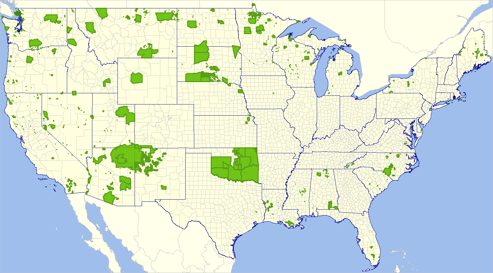 .. view developed using the CV XE GIS software. .. view using the VDA Web GIS .. nothing to install; requires only a browser; device independent; use any browser. Alaska Native Areas .. smaller view .. larger view Native Hawaiian Homeland Areas .. smaller view .. larger view Idaho Region .. Idaho & adjacent states Southern California .. Riverside-San Diego County area AIANNH Geography & Terminology American Indian, Alaska Native, and Native Hawaiian (AIANNH) areas are Native American legan and statistical areas for which the Census Bureau tabulates data from the decennial censuses and American Community Survey (ACS). The table presented below includes data from Census 2020 and ACS 2019. The legal entities consist of federally recognized American Indian reservations and off-reservation trust land areas, state-recognized American Indian reservations, and Hawaiian home lands (HHLs). American Indian tribal subdivisions and Alaska Native Regional Corporations (ANRCs) are additional types of legal entities. The statistical entities include Alaska Native village statistical areas (ANVSAs), Oklahoma tribal statistical areas (OTSAs), tribal designated statistical areas (TDSAs), and state designated tribal statistical areas (SDTSAs). American Indian, Alaska Native, Native Hawaiian Areas .. goto top AIANNH Demographic-Economic Interactive Table .. view, rank, compare demographic-economic characteristics Rows correspond to individual AIANNH areas. See more detail about these data. Mouse-over header column to view extended item/column name. All items are ACS 2019 unless indicated otherwise. Click ShowAll button between queries. See usage notes below table. See related interactive tables. Usage Notes Click ShowAll button to reset table. Value of -1 indicates that cell could not be estimated. Usage Examples (buttons below table) .. Using Find in Name search button • click "ShowAll" button then "Find in Name" to view the areas meeting the search value. .. the Navajo Nation Reservation (the default name) decreased from ACS2019 population of 172,813 to Census 2020 population of 165,168 Find your own area of interest; example .. key in Nez Perce replacing Navajo .. • click "ShowAll" button then "Find in Name" to view the Nez Perce area. it decreased from ACS2019 population of 19,251 to Census 2020 population of 18,203 Find a common group of areas; example Oklahoma Tribal Statistical Areas .. key in OTSA replacing Nez Perce .. • click "ShowAll" button then "Find in Name" to view the OTSAs. see there are 29 OTSAs; rank on Census 2020 population column to see the largest is the Creek OTSA. Using the State selection dropdown button • click "ShowAll" then "State" dropdown and choose Hawaii to view all 75 Hawaii Homeland areas. • click "ShowAll" then "State" dropdown and choose Alaska to view all 221 Alaska ANVSAs. Defintions & Column Descriptions .. goto top GeoID to be expanded About these Data .. goto top Data used in the section have been developed using a combination of Census sourced data: ACS 2019 5-year for summary level 250 and Census 2020 P.L. 94-171 data for summary level 250. Data were first developed using the ACS 2019 data (the only/most recent source of "richer, more detailed" subject matter. Census 2020 data were then integrated based on the common Census 4-character area code. Since there have been some changes in code, name or geography, caution should be used in using the 2020 data. ACS 2019 5-year summary level 250 estimates demographic-economic profile datasets • developed using DEDE. • download U.S. datasets here. .. requires DEDE userid .. terms of use: no redistribution .. suggested download folder: c:\acs1519\250\ • zip file expands to these ASC195 files (summary level 250): .. dp1_195_250.dbf .. general demographics as documented in file DP0119.dbf .. dp2_195_250.dbf .. social characteristics as documented in file DP0219.dbf .. dp3_195_250.dbf .. economic characteristics as documented in file DP0319.dbf .. dp4_195_250.dbf .. housing characteristics as documented in file DP0419.dbf • download 2019 TIGER AIANNH zipped shapefile. .. see more about the TIGER AIANNH shapefile (pdf) .. page 3-11 Geography & Related Terminology .. goto top American Indian reservations-Federal (federal AIRs) are areas that have been set aside by the United States for the use of tribes, the exterior boundaries of which are more particularly defined in the final tribal treaties, agreements, executive orders, federal statutes, secretarial orders, or judicial determinations. The Bureau of Indian Affairs maintains a list of all federally recognized tribal governments and makes final determination of the inventory of federal AIRs. The Census Bureau recognizes federal reservations (and associated off-reservation trust lands) as territory over which American Indian tribes have primary governmental authority. American Indian reservations can be legally described as colonies, communities, Indian colonies, Indian communities, Indian rancherias, Indian reservations, Indian villages, pueblos, rancherias, ranches, reservations, reserves, settlements, or villages. The Census Bureau contacts representatives of American Indian tribal governments to identify the boundaries for federal reservations through its annual Boundary and Annexation Survey. Federal reservations may cross state and all other area boundaries. American Indian reservations-State (state AIRs) are reservations established by some state governments for tribes recognized by the state. A governor-appointed state liaison provides the names and boundaries for state-recognized American Indian reservations to the Census Bureau. State reservations must be defined within a single state but may cross county and other types of boundaries. American Indian tribal subdivisions , described as additions, administrative areas, areas, chapters, county districts, communities, districts, or segments, are legal administrative subdivisions of federally recognized American Indian reservations and off-reservation trust lands or are statistical subdivisions of Oklahoma tribal statistical areas (OTSAs). These entities are internal units of self-government or administration that serve social, cultural, and/or economic purposes for the American Indians on the reservations, off-reservation trust lands, or OTSAs. The Census Bureau obtains the boundary and name information for tribal subdivisions from tribal governments. Alaska Native Regional Corporations (ANRCs): ANRCs are corporate entities organized to conduct both for-profit and non-profit affairs of Alaska Natives pursuant to the Alaska Native Claims Settlement Act. ANRCs have legally defined boundaries that subdivide all of Alaska into twelve regions (except for the area within the Annette Island Reserve). The non-profit officials of ANRCs review their legal boundary and may, in the absence of participation by the Alaska Native village official, act as proxy in the delineation of ANVSAs in their regions. Alaska Native Village Statistical Areas (ANVSAs): ANVSAs are statistical geographic entities representing permanent and/or seasonal residences of Alaska Natives who are members of, or receive governmental services from, the defining Alaska Native village (ANV). ANVSAs are intended to include only an area where Alaska Natives, especially members of the defining ANV, represent a substantial proportion of the population during at least one season of the year. Hawaiian Home Lands (HHLs): HHLs are areas held in trust for Native Hawaiians by the State of Hawaii, according to the Hawaiian Homes Commission Act of 1920, as amended. Based on a compact between the federal government and the new State of Hawaii in 1959, the Hawaii Admission Act vested land title and responsibility for the program with the State. An HHL is not a governmental unit; rather, a home land is a tract of land with a legally defined boundary that is owned by the state, which, as authorized by the Act, may lease to one or more Native Hawaiians for residential, agricultural, commercial, industrial, pastoral, and/or any other activities authorized by state law. The Census Bureau obtains the names and boundaries for Hawaiian home lands from State officials. The names of the home lands are based on the traditional ahupua'a names of the Crown and government lands of the Kingdom of Hawaii from which the lands were designated or from the local name for an area. Off-reservation trust lands are areas for which the United States holds title in trust for the benefit of a tribe (tribal trust land) or for an individual American Indian (individual trust land). Trust lands can be alienated or encumbered only by the owner with the approval of the Secretary of the Interior or his/her authorized representative. Trust lands may be located on or off a reservation; however, the Census Bureau tabulates data only for off-reservation trust lands with the off-reservation trust lands always associated with a specific federally recognized reservation and/or tribal government. As for federally recognized reservations, the Census Bureau obtains the boundaries of off-reservation trust lands from American Indian tribal governments through its annual Boundary and Annexation Survey. The Census Bureau recognizes and tabulates data for reservations and off-reservation trust lands because American Indian tribes have primary governmental authority over these lands. The Census Bureau does not identify fee land (or land in fee simple status) or restricted fee lands as specific geographic areas. Oklahoma Tribal Statistical Areas (OTSAs): OTSAs are statistical areas that were identified and delineated by the Census Bureau in consultation with federally recognized American Indian tribes based in Oklahoma. An OTSA is intended to represent the former American Indian reservation that existed in Indian and Oklahoma territories prior to Oklahoma statehood in 1907. OTSAs are intended to provide geographic entities comparable to the former Oklahoma reservations so that statistical data can be viewed over time. OTSAs were referred to as Tribal Jurisdiction Statistical Areas (TJSAs) in the 1990 Census data products. State Designated Tribal Statistical Areas (SDTSAs): SDTSAs are statistical geographic areas identified and delineated for state recognized tribes that are not federally recognized and do not have an American Indian reservation or off-reservation trust land. The Census Bureau works with a governor appointed state liaison to delineate statistical areas for state-recognized tribes. SDTSAs do not cross state lines and are limited to the state in which the respective tribe is officially recognized. SDTSAs provide state recognized tribes without reservations statistical data for a geographic area that encompasses a substantial concentration of tribal members. SDTSAs were called State Designated American Indian Statistical Areas (SDAISAs) for Census 2000. Tribal Designated Statistical Areas (TDSAs): TDSAs are statistical geographic entities identified and delineated for the Census Bureau by federally recognized American Indian tribes that do not currently have an American Indian reservation and/or off-reservation trust land. A TDSA is intended to encompass a compact and contiguous area that contains a concentration of individuals who identify with the delineating federally recognized American Indian tribe. TDSAs are also intended to be comparable to American Indian reservations within the same state or region and provide a means for reporting statistical data for the area. Support Using these Resources .. goto top Learn more about demographic economic data and related analytical tools. Join us in a Web session. There is no fee for these Web sessions. Each informal session is focused on a specific topic. The open structure also provides for Q&A and discussion of application issues of interest to participants. ProximityOne User Group Join the ProximityOne User Group to keep up-to-date with new developments relating to geographic-demographic-economic decision-making information resources. Receive updates and access to tools and resources available only to members. Use this form to join the User Group. Additional Information ProximityOne develops geographic-demographic-economic data and analytical tools and helps organizations knit together and use diverse data in a decision-making and analytical framework. We develop custom demographic/economic estimates and projections, develop geographic and geocoded address files, and assist with impact and geospatial analyses. Wide-ranging organizations use our software, data and methodologies to analyze their own data integrated with other data. |
|
|